

• Waterproof • Tear-Resistant • Topographic Map
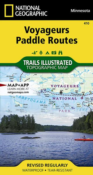
Located at the border of Minnesota and Ontario, Canada, Voyageurs National Park is defined by its interconnected waterways which entice you to leave your car behind and explore by kayak, canoe, houseboat, or motorboat. Lying on the intersection of the aquatic and terrestrial ecosystems, visitors from around the world enjoy the geologic outcroppings formed by ancient volcanoes, a diverse population of wildlife, the boreal forest, a history rich in culture, and starry nights.
This map guide highlights six carefully curated paddle routes that help you circumnavigate the numerous lakes in the park. From day trips to week long adventures, the huge lakes of Rainy, Sand Point, Namakan, and Kabetogama are the life blood of the park, offering a plethora of recreation opportunities along your trip. The suggested routes are only intended as a guideline, as each may vary depending on weather conditions, physical fitness, or the possible side routes and other natural wonders explored along the way.
Each of the paddle routes includes a map with the route highlighed and a description that provides detailed explanations with prominent landmarks and important turns noted. The combination of map and text descriptions helps make the complex lake system of Voyagers National Park much easier to navigate.
Every Trails Illustrated map is printed on "Backcountry Tough" waterproof, tear-resistant paper. A full UTM grid is printed on the map to aid with GPS navigation.
Specifications:
Folded Size 4" x 7.5"
Flat Size 26.25" x 19.5"
Scale 1:70,000
Copyright Date 2019
Weight Oz 2
Dim Thickness No
Page Count 2